Ruinerwoldseweg 7975 PD Uffelte
Price on request

Description
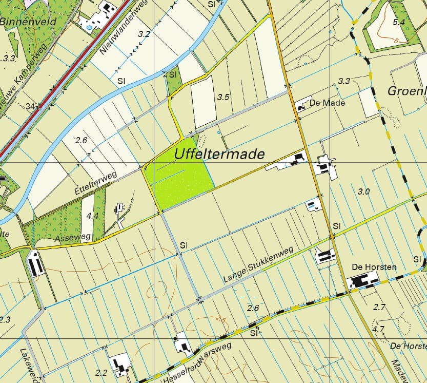
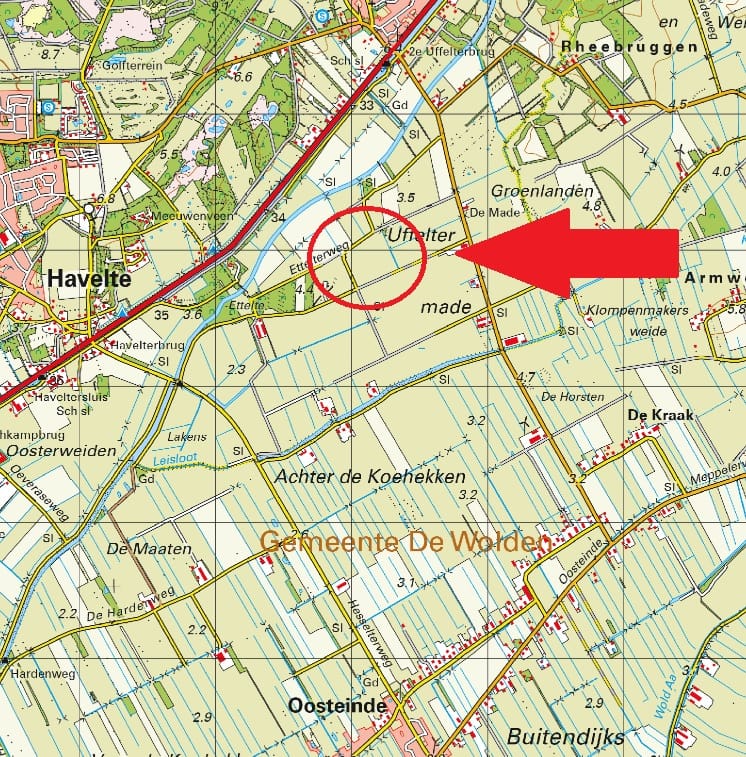
Omschrijving: Percelen cultuurgrond gelegen aan de Ruinerwoldseweg/Asseweg te Uffelte;
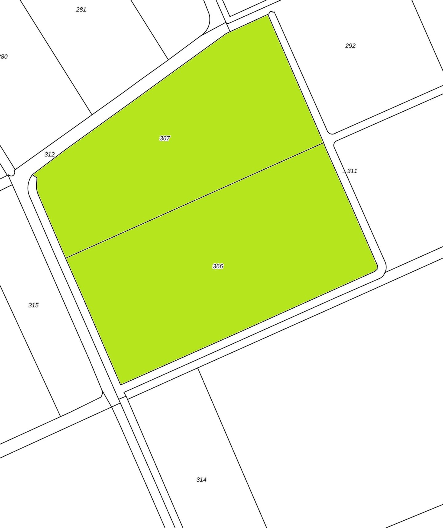
Oppervlakte: 09.47.86 ha;
Kadastrale aanduiding:
Gemeente Havelte, sectie P, nummer 366, groot 05 ha 10 are 45 ca;
Gemeente Havelte, sectie P, nummer 367, groot 04 ha 37 are 41 ca;
Ruilverkaveling: Niet van toepassing;
Productierechten: Niet van toepassing;
Uitbetalingsrechten: Niet van toepassing;
Natura2000: Niet van toepassing;
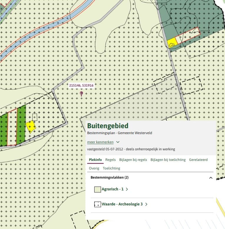
Bestemmingsplan: Enkelbestemming Agrarisch 1, Dubbelbestemming Waarde – Archeologie 3;
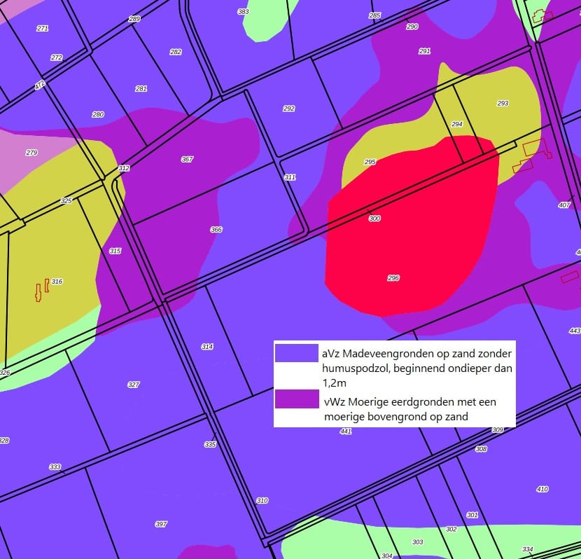
Bodem: Madeveengronden en moerige eerdgronden;
Kettingbeding: Overdrachtsbelasting i.v.m. verkoop binnen 10 jaar.
Oppervlakte: 09.47.86 ha;
Kadastrale aanduiding:
Gemeente Havelte, sectie P, nummer 366, groot 05 ha 10 are 45 ca;
Gemeente Havelte, sectie P, nummer 367, groot 04 ha 37 are 41 ca;
Ruilverkaveling: Niet van toepassing;
Productierechten: Niet van toepassing;
Uitbetalingsrechten: Niet van toepassing;
Natura2000: Niet van toepassing;
Bestemmingsplan: Enkelbestemming Agrarisch 1, Dubbelbestemming Waarde – Archeologie 3;
Bodem: Madeveengronden en moerige eerdgronden;
Kettingbeding: Overdrachtsbelasting i.v.m. verkoop binnen 10 jaar.
Features
Transfer of ownership
- Asking price
- Price on request
- Listed since
-
- Status
- Available
- Acceptance
- Available in consultation
Construction
- Main use
- Land only
Surface areas
- Total area
- 9 ha 47 a 86 ca
- Type of land
- Pastureland
- Field plots
- 9 ha 47 a 86 ca
Cadastral data
-
HAVELTE P 366
- Cadastral map
- Ownership situation
- 5 ha 10 a 45 ca (whole parcel)
-
HAVELTE P 367
- Ownership situation
- 4 ha 37 a 41 ca (whole parcel)
Real estate agent
Photos