
Sales history
- Listed since
- June 5, 2025
Description
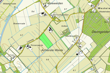
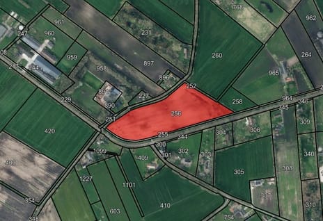
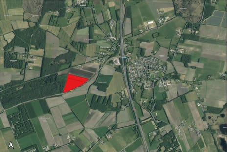
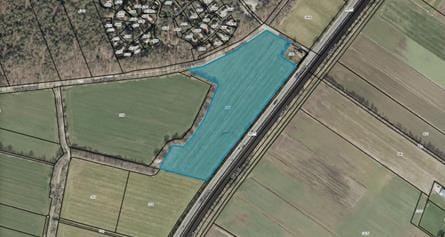
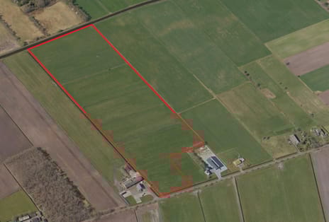
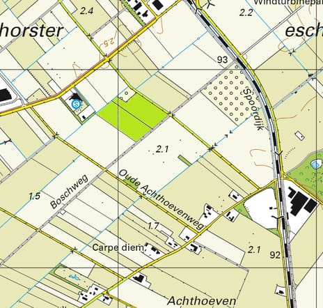
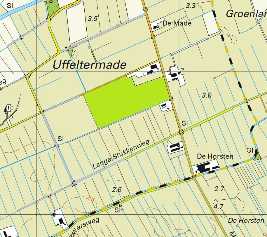
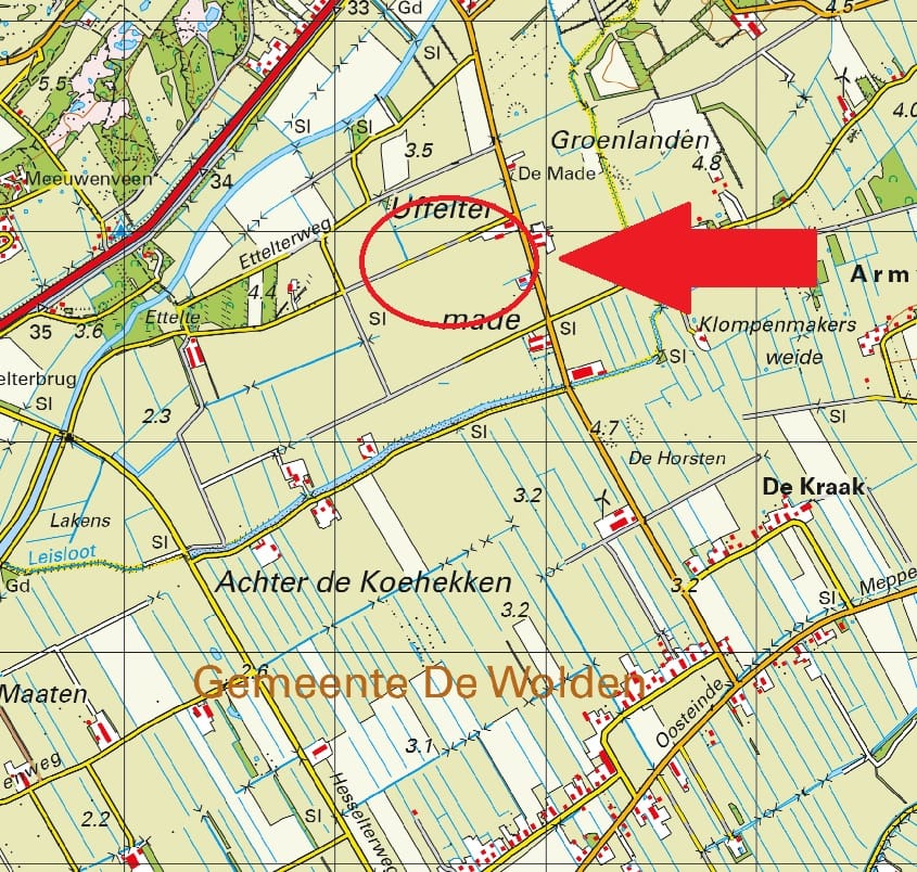
Omschrijving: Perceel cultuurgrond gelegen aan de Ruinerwoldseweg te Uffelte;
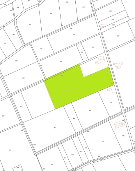
Oppervlakte: circa 13.73.96 ha;
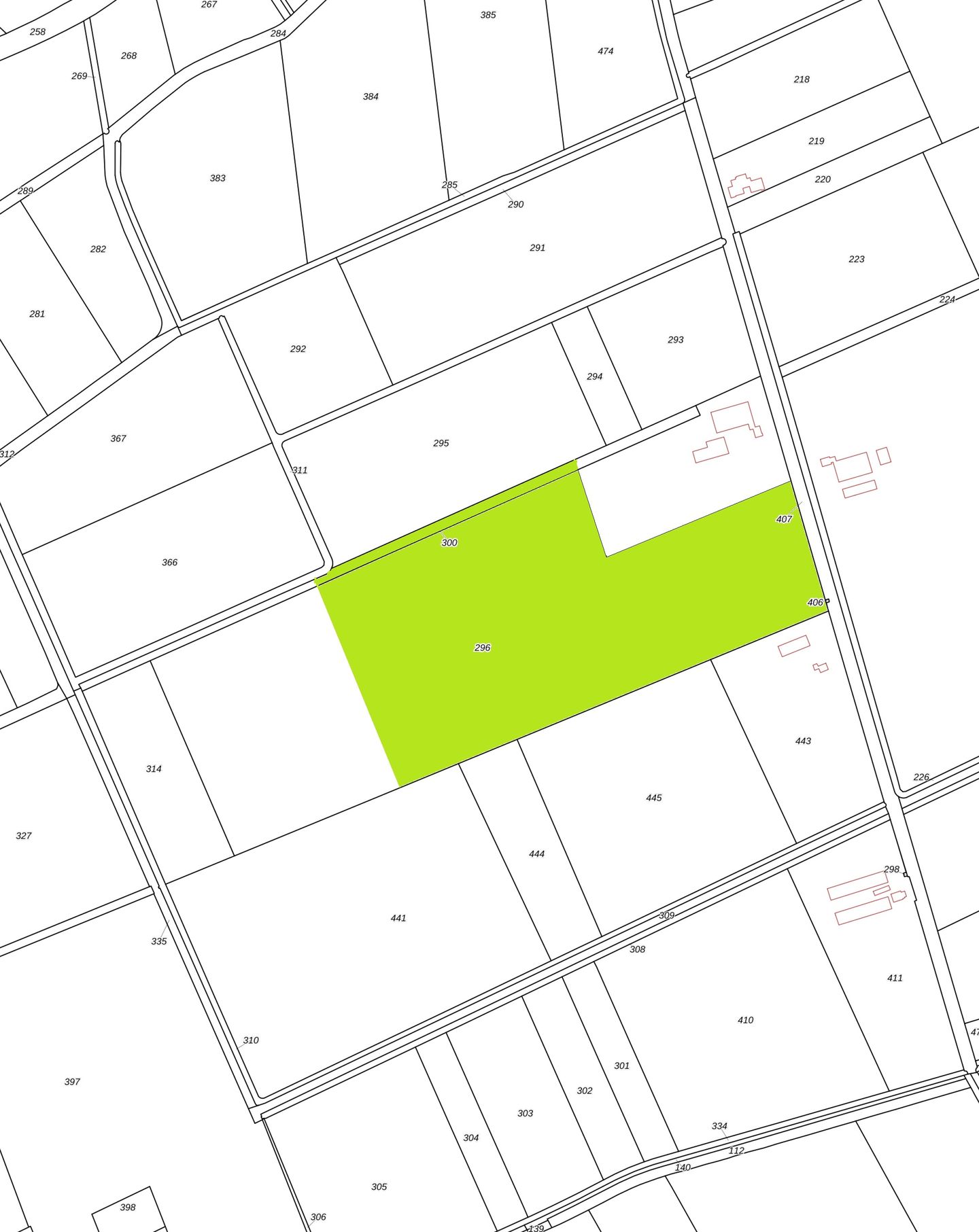
Kadastrale aanduiding:
Gemeente Havelte, sectie P, nummer 296 deels circa 13.47.56 ha;
Gemeente Havelte, sectie P, nummer 300 deels circa 00.26.40 ha;
Ruilverkaveling: Niet van toepassing;
Productierechten: Niet van toepassing;
Uitbetalingsrechten: Niet van toepassing;
Natura2000: Niet van toepassing;
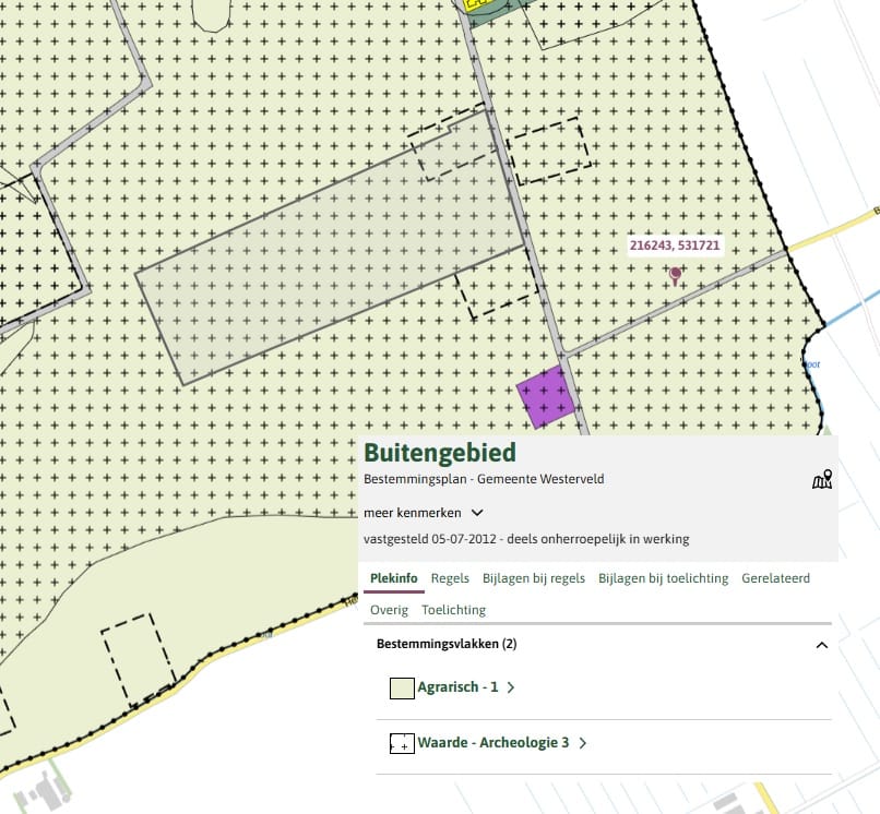
Bestemmingsplan: Enkelbestemming Agrarisch 1, Dubbelbestemming Waarde – Archeologie 3;
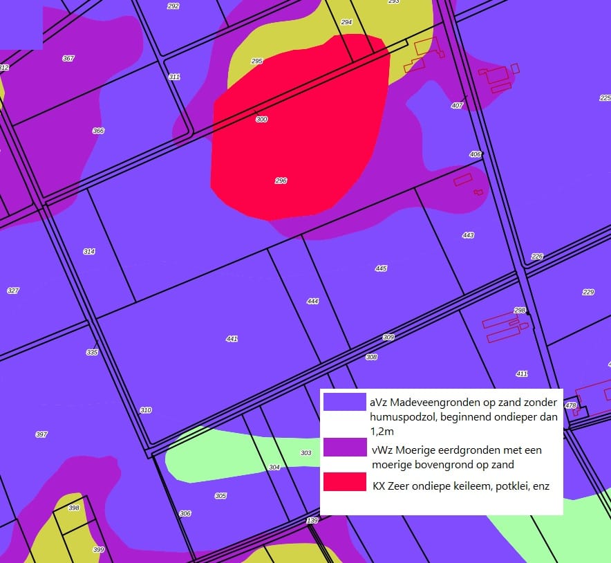
Bodem: Madeveengronden en moerige eerdgronden;
Kettingbeding: Overdrachtsbelasting i.v.m. verkoop binnen 10 jaar.
Bijzonderheden: Inclusief kavelpad naastgelegen en spuitvrije zone rond bouwblok van toepassing.
Oppervlakte: circa 13.73.96 ha;
Kadastrale aanduiding:
Gemeente Havelte, sectie P, nummer 296 deels circa 13.47.56 ha;
Gemeente Havelte, sectie P, nummer 300 deels circa 00.26.40 ha;
Ruilverkaveling: Niet van toepassing;
Productierechten: Niet van toepassing;
Uitbetalingsrechten: Niet van toepassing;
Natura2000: Niet van toepassing;
Bestemmingsplan: Enkelbestemming Agrarisch 1, Dubbelbestemming Waarde – Archeologie 3;
Bodem: Madeveengronden en moerige eerdgronden;
Kettingbeding: Overdrachtsbelasting i.v.m. verkoop binnen 10 jaar.
Bijzonderheden: Inclusief kavelpad naastgelegen en spuitvrije zone rond bouwblok van toepassing.
Involved real estate agent
Map
Map is loading...

Cadastral boundaries
Buildings
Travel time
Gain insight into the reachability of this object, for instance from a public transport station or a home address.