Description
VERKOOP BIJ INSCHRIJVING
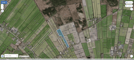
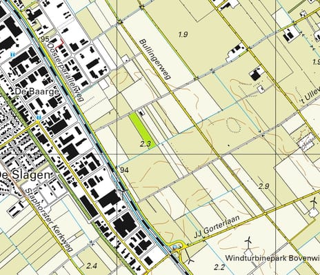
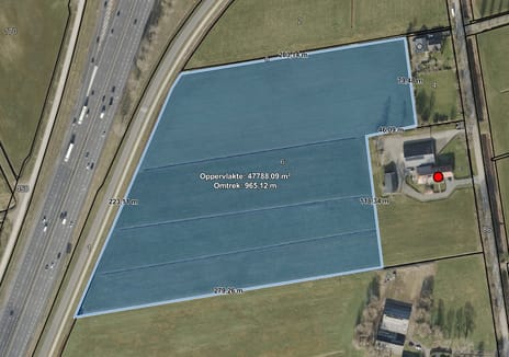
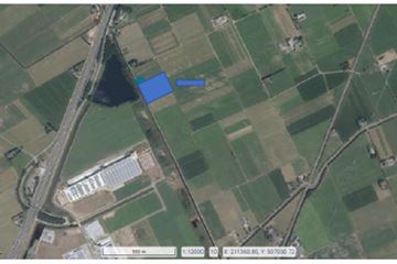
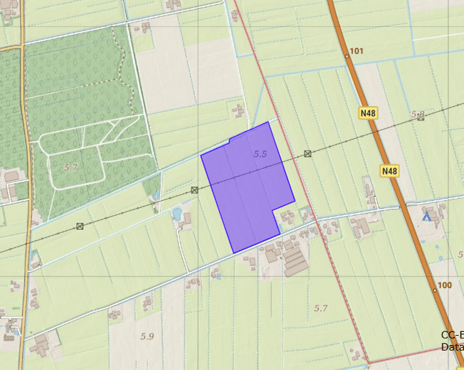
Omschrijving: Percelen cultuurgrond gelegen aan de B.H. Spijkerweg te Punthorst;
Oppervlakte: 08.34.05 ha;
Kadastrale aanduiding:
Gemeente Staphorst, sectie AR, nummer 211, groot 00.11.75 ha
Gemeente Staphorst, sectie AR, nummer 3723, groot 01.96.85 ha
Gemeente Staphorst, sectie AR, nummer 3725, groot 00.31.30 ha
Gemeente Staphorst, sectie AR, nummer 3726, groot 02.36.95 ha
Gemeente Staphorst, sectie AR, nummer 3727, groot 00.35.40 ha
Gemeente Staphorst, sectie AR, nummer 5138, groot 03.21.80 ha
Ruilverkaveling: Niet van toepassing;
Productierechten: Niet van toepassing;
Natura2000: Niet van toepassing;
Bestemmingsplan: Enkelbestemming Agrarisch, Dubbelbestemming Waarde – Archeologie 6 en Leiding – Hoogspanningsverbinding;
Bodem: Beekeerdgronden, Veldpodzolgronden en Gooreerdgronden;
Inschrijfstukken zijn op te vragen bij ons kantoor. Inschrijven kan tot uiterlijk 03 december 2026 - 12.00 uur
Omschrijving: Percelen cultuurgrond gelegen aan de B.H. Spijkerweg te Punthorst;
Oppervlakte: 08.34.05 ha;
Kadastrale aanduiding:
Gemeente Staphorst, sectie AR, nummer 211, groot 00.11.75 ha
Gemeente Staphorst, sectie AR, nummer 3723, groot 01.96.85 ha
Gemeente Staphorst, sectie AR, nummer 3725, groot 00.31.30 ha
Gemeente Staphorst, sectie AR, nummer 3726, groot 02.36.95 ha
Gemeente Staphorst, sectie AR, nummer 3727, groot 00.35.40 ha
Gemeente Staphorst, sectie AR, nummer 5138, groot 03.21.80 ha
Ruilverkaveling: Niet van toepassing;
Productierechten: Niet van toepassing;
Natura2000: Niet van toepassing;
Bestemmingsplan: Enkelbestemming Agrarisch, Dubbelbestemming Waarde – Archeologie 6 en Leiding – Hoogspanningsverbinding;
Bodem: Beekeerdgronden, Veldpodzolgronden en Gooreerdgronden;
Inschrijfstukken zijn op te vragen bij ons kantoor. Inschrijven kan tot uiterlijk 03 december 2026 - 12.00 uur
Map
Map is loading...

Cadastral boundaries
Buildings
Travel time
Gain insight into the reachability of this object, for instance from a public transport station or a home address.